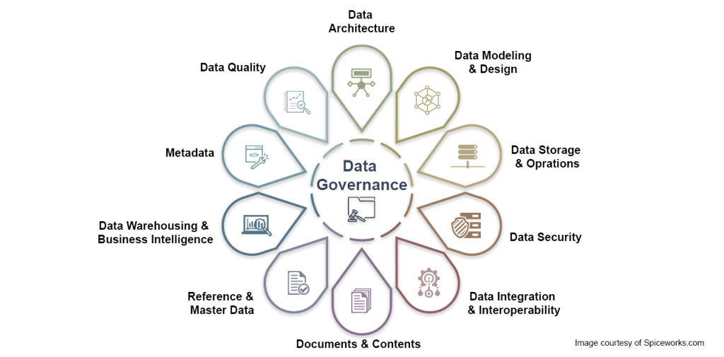
Data governance is the process of managing the availability, usability, integrity and security of the data in enterprise systems, based on internal standards and policies that also control data usage. Effective data governance ensures that data is consistent and trustworthy.
Documentation
GeoData Modeler automatically generates comprehensive schema documentation directly from your enterprise geodatabase. This allows both GIS professionals and non-technical staff to easily understand the organization and relationships within your complex data model.
• Automatically generate schema documentation directly from your geodatabase
• Comprehensive reports cover attributes, domains, relationships, and more
• Use as reference for GIS and non-GIS staff to understand data relationships
• Onboard new hires by walking through the full data model and workflows
Having a clear view into how all the pieces fit together is critical for collaboration, training, and knowledge transfer. The schema reports serve as a robust reference guide, ensuring everyone from analysts to executives is on the same page.
Collaboration and Data Modeling
Designing and maintaining an enterprise geodatabase schema is an intricate process and can involve multiple teams. GeoData Modeler provides full transparency to facilitate controlled, coordinated schema updates.
• Design and refine geodatabase schema with full transparency
• Compare proposed changes across teams with schema reports
• Facilitate collaboration to align on enterprise data model standards
• Easily share and export reports in various formats
With visibility into existing and proposed schema designs, GIS teams can work together effectively. Schema reports make it simple to get everyone aligned upfront before implementing changes.
Reporting
When working on major geodatabase initiatives or simply filing regular status updates, you need clear materials to communicate project details. GeoData Modeler allows you to generate reports that are clear for even non-technical audiences.
• Maintain accurate records on a regular export schedule
• Demonstrate data quality and highlight schema strengths
• Justify new initiatives by mapping data model to requirements
• Show value and return on investment of geodatabase
The high-quality reports leave a strong impression and instill confidence in your geodatabase management processes. This makes it easier to get buy-in and backing for new projects.
Want to learn more about how GeoData Modeler can help your organization? Reach out for a one-on-one consultation, or request a software trial to see it in action.